Baltic Sea
Unseenlabs Uncovers Threats to Subsea Cables
Market
Offshore facilities
Location
Baltic Sea - Gibraltar - Barents Sea
Date
Nov 24, 2024

In November 2024, silence fell across vital subsea cables in the Baltic Sea.
Two critical internet cables, lifelines of global connectivity, were suddenly and mysteriously disrupted. As the world speculated on causes—from accidental damage to deliberate sabotage—Unseenlabs was already piecing together a story from space. The incidents highlighted the fragility of the infrastructure that supports our interconnected world. With geopolitical tensions rising and nations scrambling to secure critical systems, events like these remind us of the invisible vulnerabilities we face—and the importance of cutting-edge technologies that can uncover them.
The Baltic Sea Disruption: A Digital Artery Severed
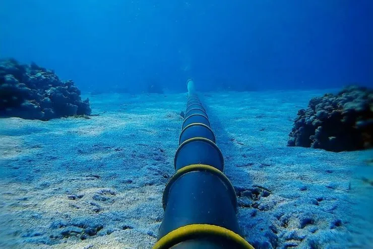
The C-Lion cable, which links Finland and Germany, is a vital 1,200-kilometer (730-mile) corridor for internet and communications data. Alongside another disrupted cable connecting Lithuania and Sweden, it forms part of a broader network supporting millions of users and countless systems.
The timing couldn’t be more sensitive. Sweden and Finland, both newly joined NATO members, are strengthening defenses against potential threats in light of Russia’s invasion of Ukraine. National governments have distributed emergency survival guides to citizens, preparing for scenarios that could include prolonged communication blackouts.

Speculation over the incidents has surged, pointing to the strategic importance of undersea cables. But in this tangled web of intrigue, one name has surfaced: Yi Peng 3, a Chinese vessel believed to be operating in the vicinity at the time of the damage. This discovery raises urgent questions about its intentions. Was it a mere coincidence or something more deliberate?
Undersea cables, largely unseen yet critical to global connectivity, are increasingly in the crosshairs of state and non-state actors alike. Pinpointing those responsible for such disruptions is not just a matter of accountability but a step toward safeguarding the digital arteries that keep the modern world humming. Could the Yi Peng 3 hold the answers, or does this event hint at a broader game of shadowy maneuvers beneath the waves?
Unseenlabs’ Role: RF Data in the Baltic Sea
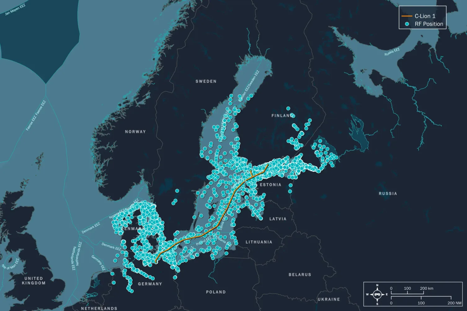
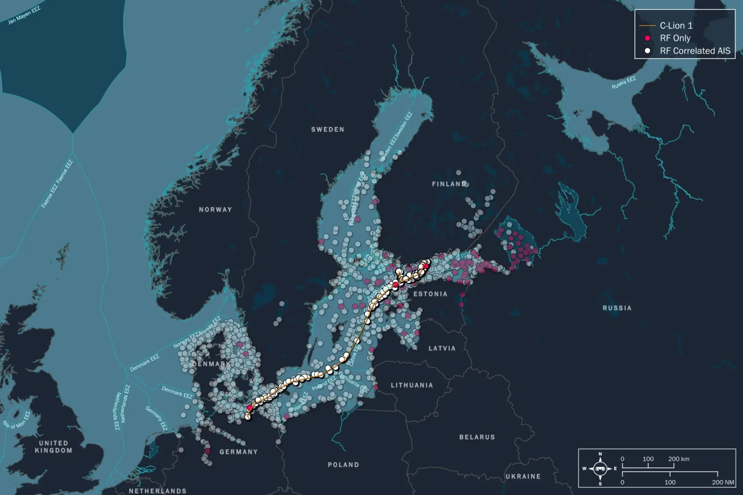
Months before the incidents, Unseenlabs conducted a targeted RF data collection campaign in the Baltic Sea. Between August 7 and August 21, our satellites captured 5,450 RF positions (88 RF only & 5362 RF correlated with AIS) in the region, focusing on the C-Lion cable’s vicinity.
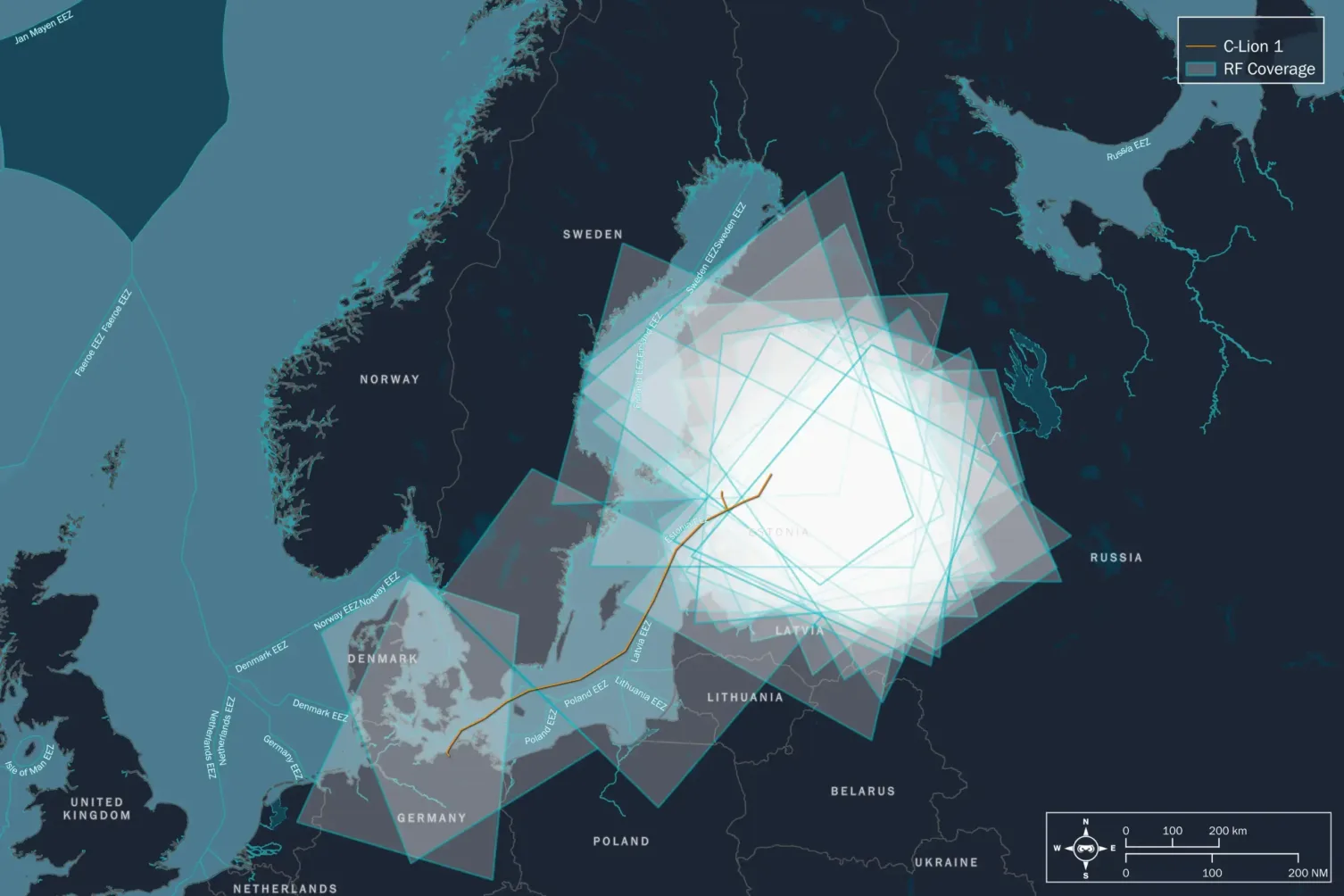
Months before the incidents, Unseenlabs conducted a targeted RF data collection campaign in the Baltic Sea.
Between August 7 and August 21, our satellites captured 5,450 RF positions (88 RF only & 5362 RF correlated with AIS) in the region, focusing on the C-Lion cable’s vicinity.
Our findings revealed:
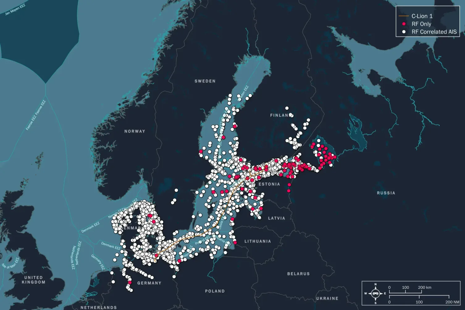
Among all these 5,450 RF positions, 5362 were correlated with AIS and 88 RF only, not transmitting any AIS signal
Let's go even deeper:
522 RF positions within 10 kilometers of the cable, of which: 519 were correlated with AIS data. 3 were RF-only, meaning they lacked any corresponding AIS signal—a potential red flag.
The Case of Yi Peng 3: A Vessel with a Hidden Agenda?
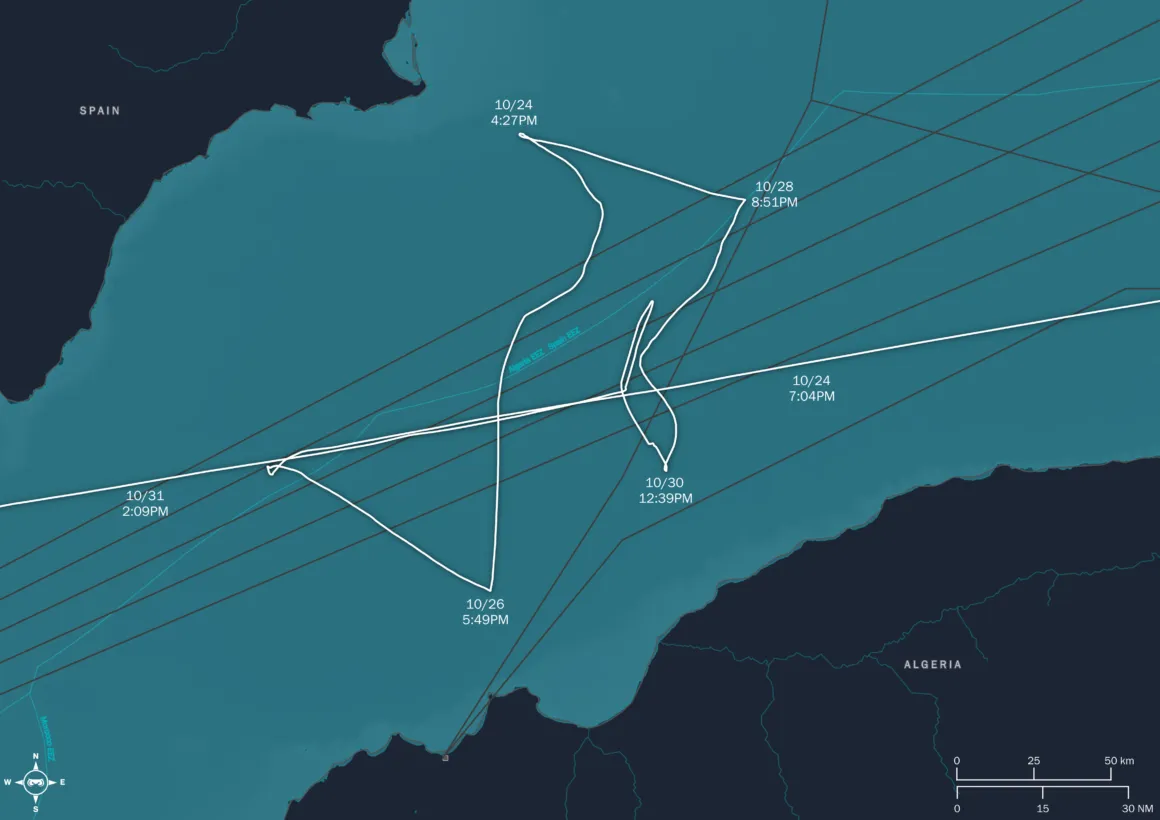
The mystery deepened in late October, as our satellites tracked the Chinese bulk carrier Yi Peng 3 near subsea cables in the Strait of Gibraltar. Bulk carriers typically follow straightforward, predictable routes, but Yi Peng 3 exhibited erratic behavior—zigzagging in ways uncharacteristic of its vessel type.
This wasn’t the first time Yi Peng 3 had raised alarms
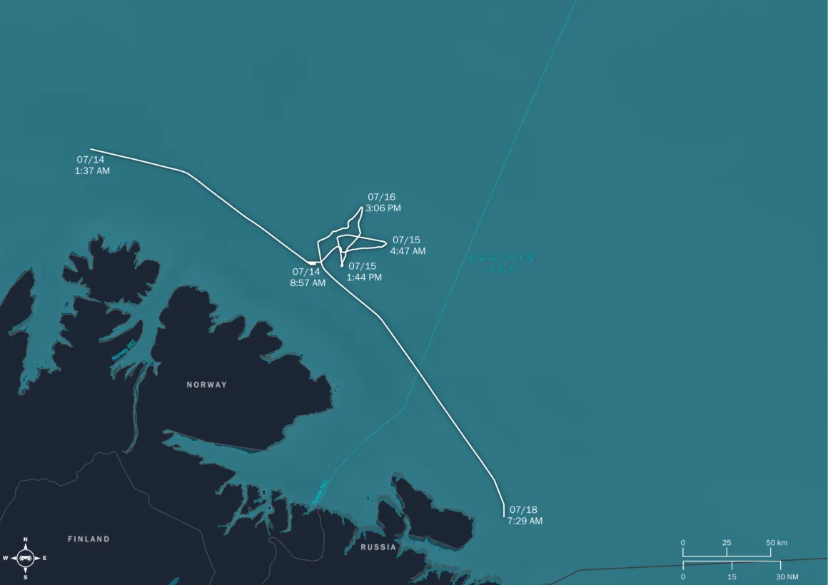
From May 9 to 13, the Yi Peng 3 exhibited unusual movements near the Suez Canal, raising concerns about its true intentions. Between July 14–17 and September 6–8, the vessel reappeared near Murmansk, a strategically significant Arctic region, further deepening the mystery surrounding its unexplained maneuvers.
The vessel’s behavior, coupled with its proximity to sensitive subsea infrastructure, suggests more than mere coincidence. Using AIS data, we identified its routes and patterns, piecing together a profile of activity that demands further scrutiny.
November Discovery: A Game-Changer in Maritime Surveillance
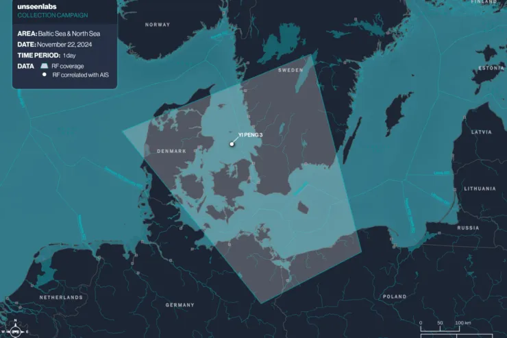
On November 22, Yi Peng 3 reappeared—this time in Denmark’s exclusive economic zone. Unseenlabs detected its RF emissions and matched them with AIS data to confirm its identity. The breakthrough? We now have its unique RF fingerprint.
Why does this matter? Ships seeking to evade detection often deactivate their AIS transponders, effectively “disappearing” from conventional tracking systems. But with RF fingerprinting, Unseenlabs can locate and monitor vessels even when their AIS is off. This capability is transformative. It allows us to follow vessels like Yi Peng 3 across the globe, uncovering hidden behaviors and potential risks in near real-time.

Connecting the Dots: Insights and Implications
The events in the Baltic Sea and the activities of Yi Peng 3 are not isolated incidents. They form part of a larger narrative: one where the safety of critical infrastructure is increasingly under threat, and traditional surveillance methods are no longer enough. Unseenlabs’ ability to correlate RF and AIS data provides a critical advantage. By detecting and identifying vessels that others cannot, we offer a new level of situational awareness to governments, NGOs, and private companies working to protect vital assets.
Whether it’s tracking suspicious patterns near subsea cables or analyzing high-risk regions like the Suez Canal and Murmansk, our technology turns uncertainty into actionable intelligence.