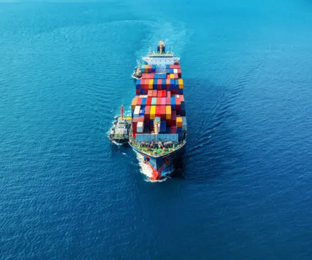
Shipowners
From Risk Mitigation to Route Optimization
Shipping drives over 80% of global trade, but shipowners face increasing challenges in ensuring safe and efficient voyages. Conflict zones, piracy, and high-risk waters elevate security threats, leading to crew safety risks, cargo disruptions, and costly delays that impact global supply chains. Illicit activities such as hidden ship-to-ship (STS) transfers, smuggling, and illegal fishing create economic losses and unfair competition, further complicating operations. The lack of visibility in remote or high-risk areas makes risk mitigation and route optimization more difficult, highlighting the need for advanced maritime intelligence solutions tailored to shipowners' needs.


Protecting Shipowners from Rising Maritime Risks & Illicit Activities
To tackle these concerns, our space-based radio frequency (RF) detection technology provides unmatched visibility at sea. By identifying and tracking vessels even when they deactivate AIS or attempt to mask their location, we can detect illicit activities such as unreported fishing, drug smuggling, and unauthorized ship transfers.
This capability enhances maritime security by delivering accurate intelligence to shipowners, helping them protect their assets and ensure compliance. Beyond security, it also supports the preservation of marine ecosystems and reinforces global efforts to combat illegal maritime activities, ensuring a safer, more transparent shipping industry.
Overcoming Key Obstacles in Maritime Operations

MONITOR
to optimize routes for fuel efficiency while also anticipating and mitigating risks in hotspot areas.
CONTROL
to prevent unauthorized ship-to-ship (STS) transfers by detecting deceptive shipping practices.
ANTICIPATE
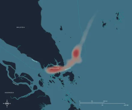
by identifying zones with clusters of "dark ships"

RF Data collection campaign in the Southern Red Sea
Between November 20 and December 29, 2023, Unseenlabs conducted a ten-day RF data collection in the Southern Red Sea, uncovering a surge in dark vessel activity amid regional turmoil. Using space-based RF detection, we tracked vessels that disabled AIS to evade detection, providing marine insurers with critical visibility into covert maritime operations. By revealing hidden activities in high-risk areas, Unseenlabs helps insurers assess and mitigate risks, ensuring stronger asset protection in volatile regions.